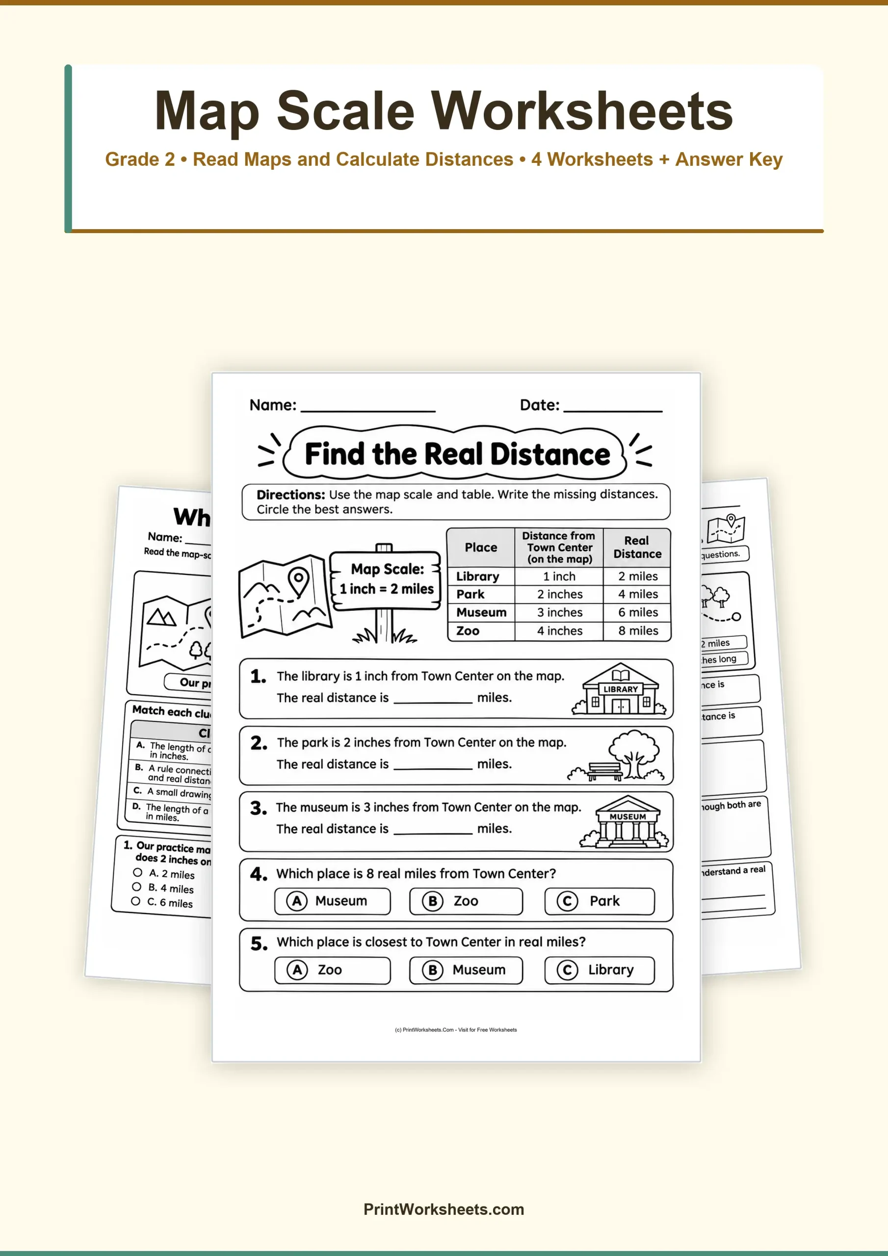
How can a short line on a map represent a trip that takes several miles? These map scale worksheets help second graders discover how distances on paper relate to distances in the real world. Students begin by learning what a map scale means, then use simple inch-to-mile relationships to calculate distances, compare trails, and choose between two possible trips. The activities combine introductory geography with practical addition, multiplication, comparison, and subtraction skills.
Understanding Map Scale Worksheets for 2nd Grade
A map scale explains the relationship between a measurement on a map and the corresponding distance in real life. In this printable set, students work primarily with the simple rule 1 inch = 2 miles. This means that a route measuring 2 inches on the map represents 4 miles in the real world.
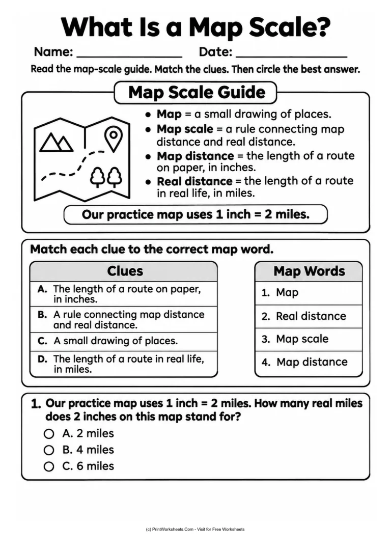
The introductory activity, What Is a Map Scale?, presents a visual reference with four important terms: map, map scale, map distance, and real distance. Students match each term to its definition before answering a multiple-choice distance question.
This vocabulary foundation matters because children need to distinguish the length shown on paper from the actual distance traveled. The definitions remain available on the activity while students practice their first conversion.
Find Real Distances Using a Map Scale
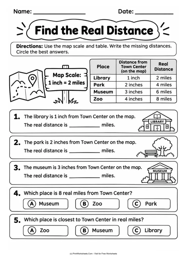
The activity Find the Real Distance introduces a town-distance table. Four familiar destinations are listed at different map distances from Town Center: Library, Park, Museum, and Zoo. Students use the provided scale to interpret distances in miles and complete missing information.
The table establishes a straightforward pattern:
- Library: 1 map inch represents 2 miles.
- Park: 2 map inches represent 4 miles.
- Museum: 3 map inches represent 6 miles.
- Zoo: 4 map inches represent 8 miles.
After working with these examples, students identify which destination is eight miles away and which place is closest to Town Center. These questions reinforce reading numerical information, comparing values, and understanding distance rather than simply recalling a definition.
Compare Two Maps with Different Scales
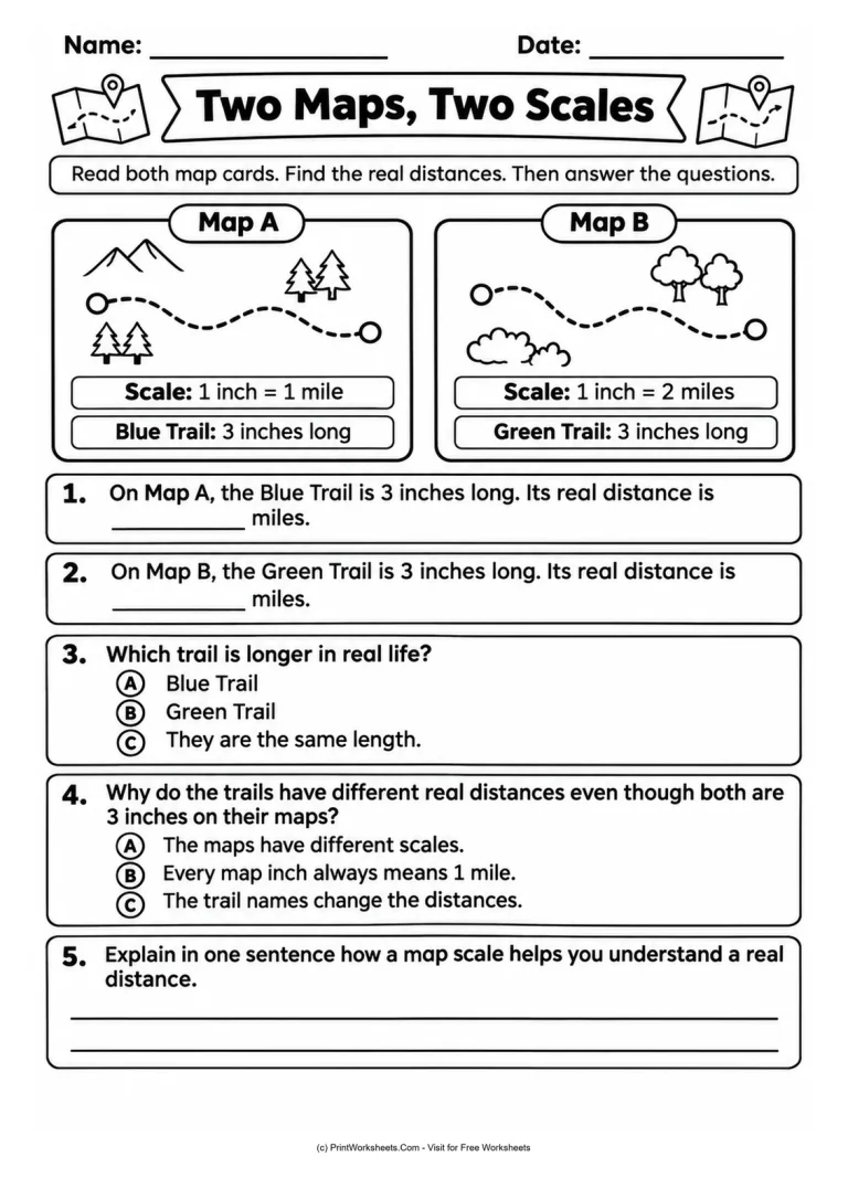
One of the most important lessons in map reading is that identical measurements do not always represent identical real-world distances. The Two Maps, Two Scales activity makes this difference visible using two illustrated trail maps.
Blue Trail and Green Trail
Map A shows the Blue Trail with a scale of 1 inch = 1 mile. Map B shows the Green Trail with a scale of 1 inch = 2 miles. Both trails are labeled as 3 inches long on their respective maps, but students discover that the actual distances differ.
Children calculate each distance, identify the longer trail, and select the explanation that correctly describes why the distances are different. A final written-response question invites students to explain, in their own words, how a map scale helps people understand real distances.
Teachers can use this comparison to emphasize an essential geographic idea: a map measurement has meaning only when it is interpreted with the correct scale.
Plan a Trip Using Map Scale and Distance
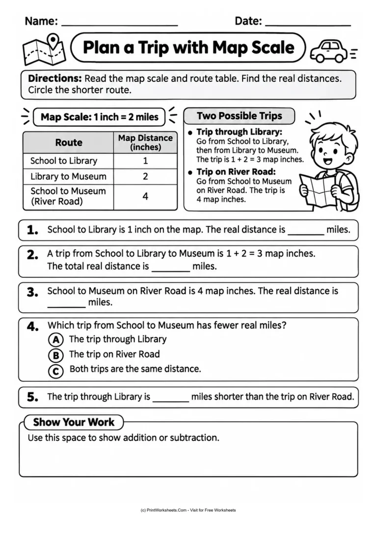
The final student activity, Plan a Trip with Map Scale, turns the concept into a simple travel decision. Students compare two ways to reach the Museum from School using the scale 1 inch = 2 miles.
Which Route Is Shorter?
The first option travels from School to Library and then from Library to Museum. These sections measure 1 inch and 2 inches on the map, giving a combined map distance of 3 inches. The second option follows River Road directly from School to Museum and measures 4 map inches.
Students convert the route measurements into real miles, decide which journey is shorter, and calculate how many miles are saved. The activity also includes a dedicated Show Your Work area where children can write their addition or subtraction.
This creates an opportunity to discuss why knowing the scale is useful when planning a trip. Rather than choosing a route based only on how a drawing looks, students use stated measurements and numerical evidence to make their decision.
Teaching Ideas for Classroom and Home
These activities can be used in sequence during an introductory geography lesson or individually for additional mathematics practice. Begin by reading the map vocabulary together and asking students to identify the difference between inches on paper and miles in real life.
For students who need extra support, create a small reference chart showing 1 inch, 2 inches, 3 inches, and 4 inches with their corresponding distances under the 1 inch = 2 miles rule. Repeated addition can help students see the conversion before they are comfortable multiplying.
When introducing the two trail maps, ask students to predict whether equally long map measurements must represent equally long journeys. Then have them use the two printed scales to test their prediction.
For the trip-planning activity, encourage students to add the map measurements of the route through the Library before converting the total to miles. The route diagrams and illustrations support the situations, while the explicitly stated distances provide the numbers for calculation.
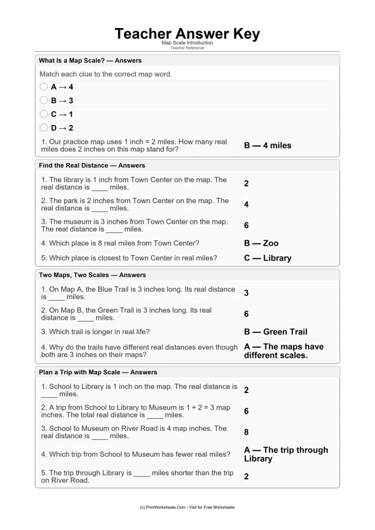
A separate Teacher Answer Key provides answers for the vocabulary matching, objective distance calculations, multiple-choice comparisons, and route problems. For the open-ended explanation, teachers can look for an accurate statement connecting map distance with real distance.
Printable Map Scale Practice
Use this printable PDF set to introduce map scale vocabulary, practice inch-to-mile conversions, compare different map scales, and solve a practical route-planning problem. The black-and-white activities are suitable for classroom instruction, geography centers, independent practice, or guided learning at home.
Start with the introductory guide, continue through the distance activities, and finish by asking students to explain how a map scale helps them understand the world beyond the map.