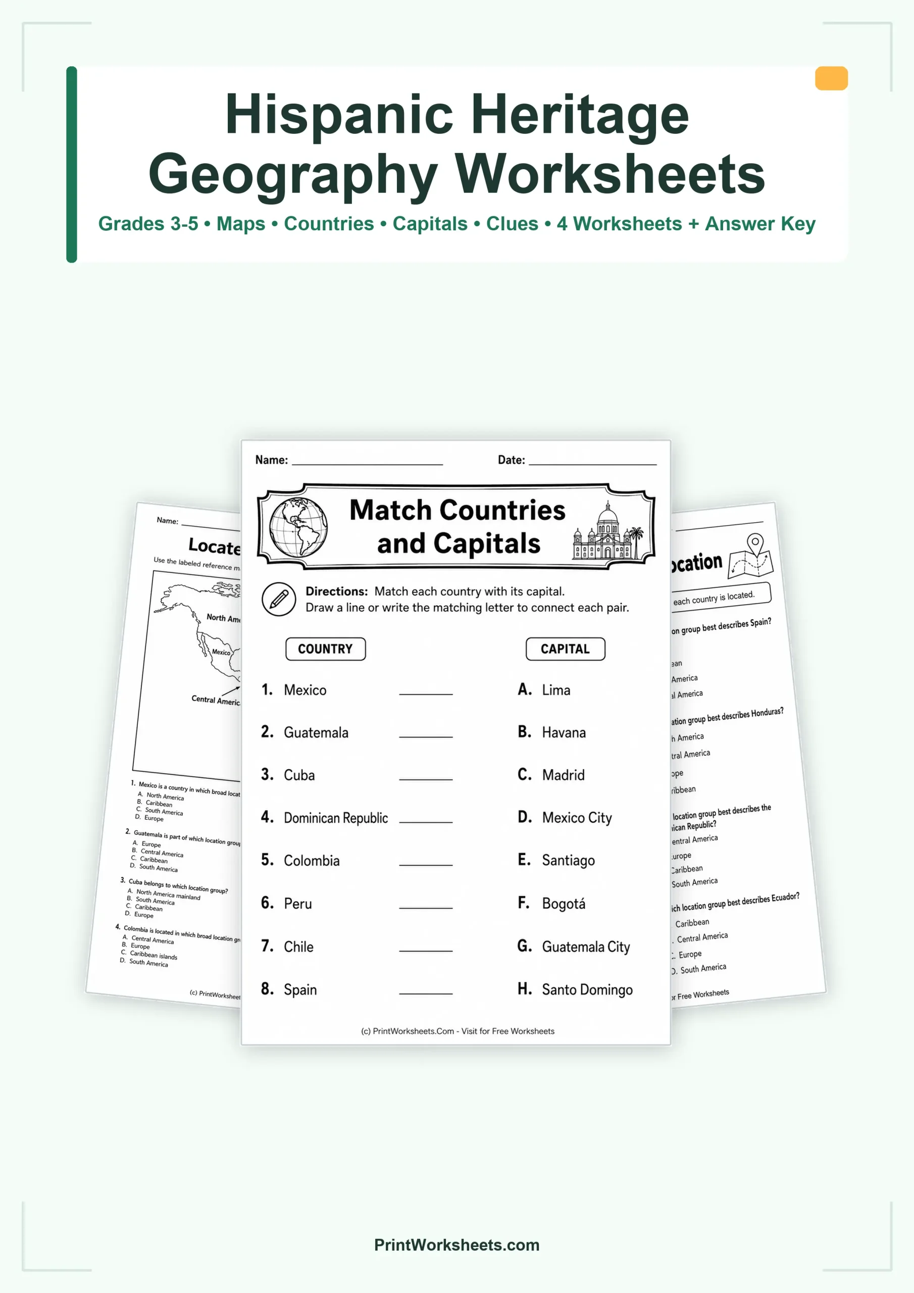
Hispanic Heritage geography worksheets can give students a concrete way to connect countries with regions, capitals, and map-based location clues. This printable set for Grades 3-5 includes four student worksheets that move beyond simple country-name recognition. Students first work with a labeled reference map, then match countries and capitals, classify places by broad location, and finally solve geography clues using relative position, coastlines, continents, and islands. A teacher answer key covers all four activities.
Hispanic Heritage geography worksheets with map and region practice
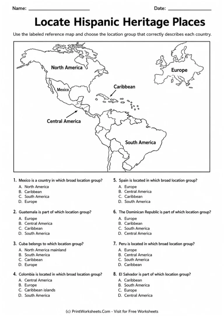
The first worksheet, “Locate Hispanic Heritage Places,” provides a reference map labeled North America, Central America, Caribbean, South America, and Europe. Students use that map to identify the broad location group for Mexico, Guatemala, Cuba, Colombia, Spain, the Dominican Republic, Peru, and El Salvador. Because the labels remain visible while students answer, this page works well as an introductory activity or as supported practice for students who are still developing confidence with world geography.
The regional choices also help students notice that Hispanic heritage connects places across more than one part of the world. Mexico is identified with North America, Guatemala and El Salvador with Central America, Cuba and the Dominican Republic with the Caribbean, Colombia and Peru with South America, and Spain with Europe. The task keeps the geography focus clear while giving students repeated practice reading broad location categories.
Build country and capital knowledge
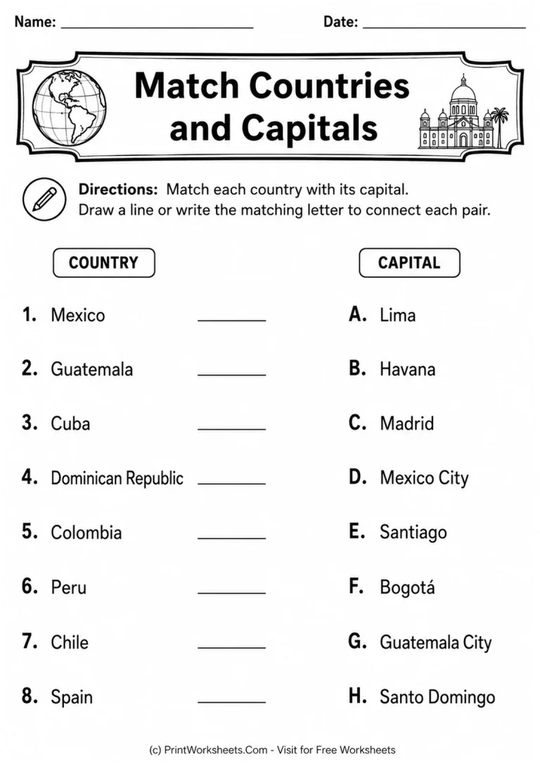
The second page changes the response format with a country-and-capital matching activity. Students connect Mexico with Mexico City, Guatemala with Guatemala City, Cuba with Havana, the Dominican Republic with Santo Domingo, Colombia with Bogotá, Peru with Lima, Chile with Santiago, and Spain with Madrid. They can draw lines or write the matching letters, so the page is easy to use for independent work, partner review, or a quick geography center.
Teachers who want to extend the heritage theme beyond geography can pair this set with Hispanic Heritage Month vocabulary worksheets. The vocabulary practice offers a different skill focus while keeping students within the same seasonal study.
Compare regions without relying on the reference map
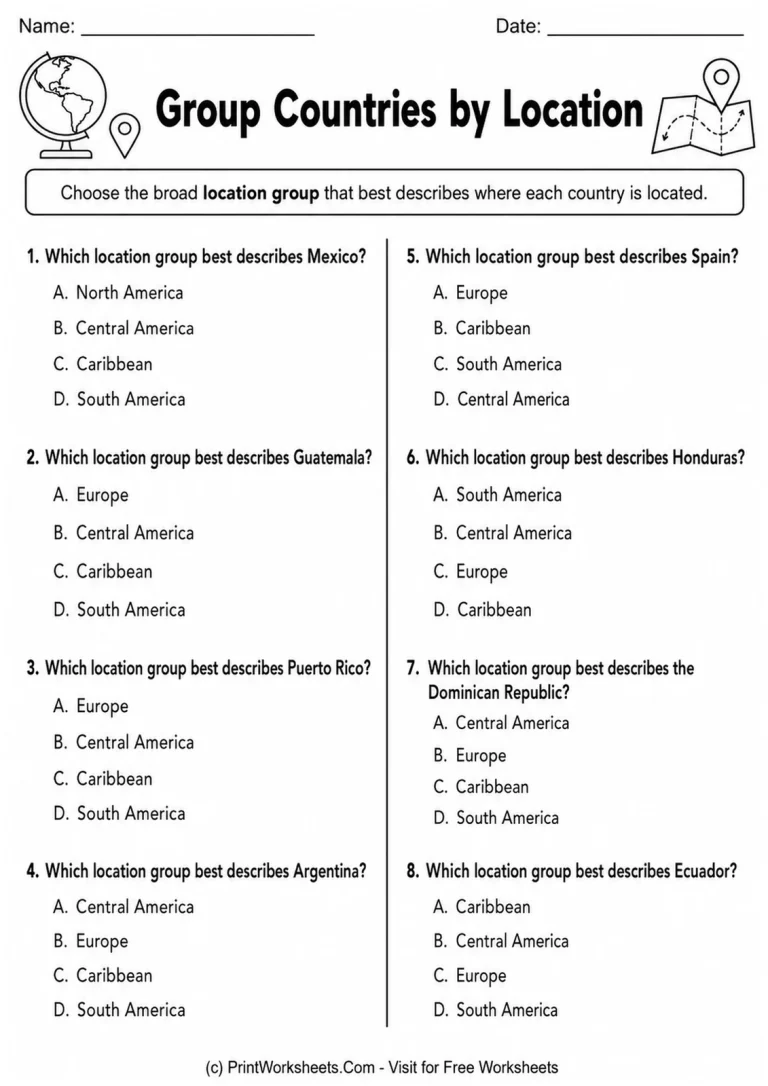
On “Group Countries by Location,” students apply the same broad-region idea in a fresh set of questions. Mexico, Guatemala, Puerto Rico, Argentina, Spain, Honduras, the Dominican Republic, and Ecuador are classified as North America, Central America, Caribbean, South America, or Europe. This gives teachers a useful follow-up after the map-supported first page because students must retrieve the location categories from what they have learned rather than simply reading every answer from the map.
The additional countries and places also widen the geographic range of the set. Puerto Rico and the Dominican Republic reinforce Caribbean geography, Argentina and Ecuador add South American examples, and Honduras gives another Central American example. The repeated regional language makes the page suitable for review before students move to more demanding clue-based questions.
Use geographic clues for deeper reasoning
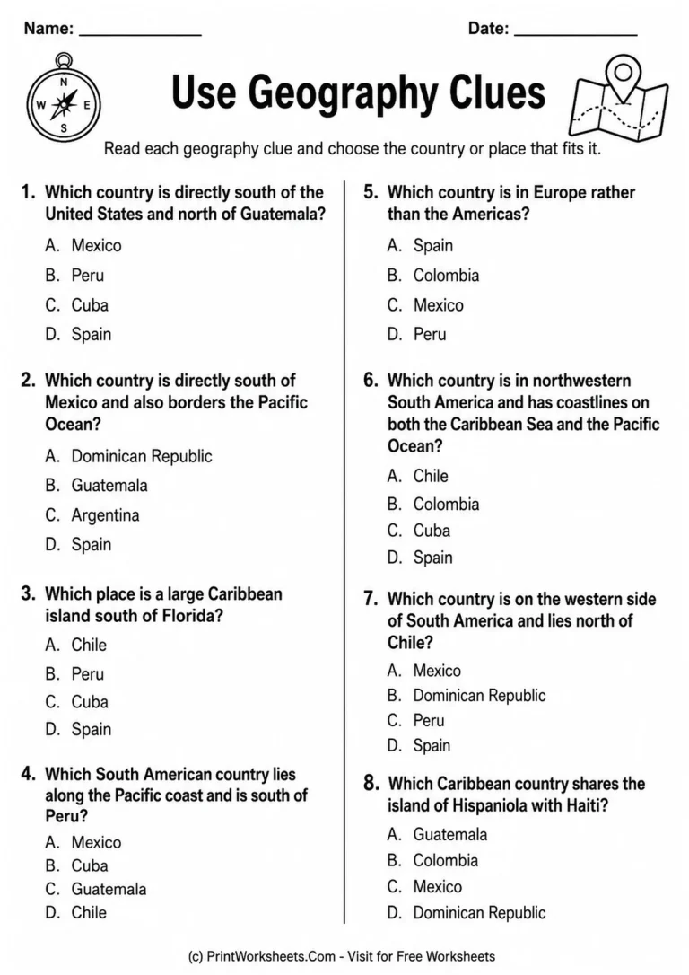
The fourth student worksheet asks learners to “Use Geography Clues.” Instead of identifying only a region, students interpret specific location facts. They determine that Mexico is south of the United States and north of Guatemala, recognize Guatemala as a country south of Mexico with a Pacific coast, identify Cuba as a large Caribbean island south of Florida, and locate Chile along the Pacific coast south of Peru.
The remaining clues broaden that reasoning. Students identify Spain as the European choice, Colombia as the northwestern South American country with coastlines on both the Caribbean Sea and Pacific Ocean, Peru as lying on the western side of South America north of Chile, and the Dominican Republic as the country sharing Hispaniola with Haiti. These questions make the set especially useful when students are ready to move from memorizing names to explaining where places are in relation to other geographic features.
Ways to use the four-page set
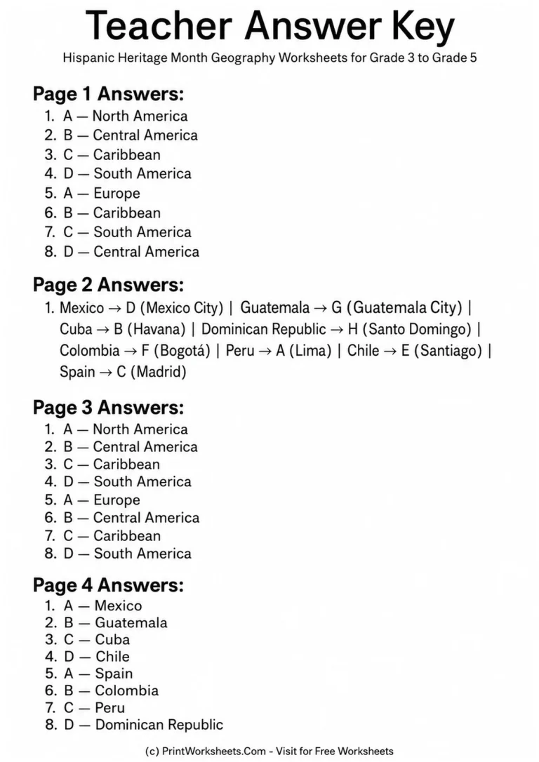
The pages can be taught in sequence or assigned separately. Start with the labeled map for guided instruction, use the capitals page for factual recall, move to independent regional grouping, and finish with the clue page as an application task. The included teacher answer key makes checking straightforward across all four worksheets.
For a broader Hispanic Heritage Month unit, students can continue with Hispanic Heritage Month biography worksheets to learn about people and contributions, or use Hispanic Heritage Month writing prompts for written reflection. Together, these options let teachers keep the geography pages focused while offering natural extensions into reading, history, and writing.